GPS Development
We are an organization dedicated to the management and innovation of integral technology services, impacting in an efficient and effective way the operation and results of our clients, providing added value and improving their management.
We have the experience and knowledge developing tools in various software platforms, using modern programming languages. We have an extensive experience developing applications with Oracle and Microsoft development and databases tools, implementation of Web pages with access to local and/or remote databases, development of SIG AM/FM geographical information systems using ESRI development tools.
Customer and Infrastructure Census
Census service, surveys and land survey, structuring databases through which cartographic (GIS) and / or commercial information is managed, focused on the needs and characteristics of the operation of utility companies.
The benefits for our clients are:
Geographical location of their customers
Geographical location of their potential clients
Identify service coverage
Update of commercial information databases
Data Conversion and Implentation of Geographical Information System (GIS)
Implementation of Geographic Information Systems (GIS) for public utilities, which allow them to manage in a timely and effective manner their operation, supporting the making of strategic business decisions.
This process is based on the Use and execution of technological tools, which support processes standardized and with quality.
Technologies:
MOBILE, WEB AND GIS TECHNOLOGY, BASED ON: ARCGIS BY ESRI – MICROSOFT .NET. – ORACLE DB.
MOBILE SOLUTIONS: ANDROID.
CLOUD SOLUTIONS: AMAZON WEB SERVICES.
DEVELOPMENT: HTML5, CSS3, JSS, ANGULARJS.
Request information:
Some products:
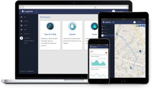
 Solution for work orders management and staff activities control, which can be integrated with the commercial information system of your company.
Benefits:
About 50% operations cost savings.
Maximization staff’s productivity.
Auditory registers.
Process optimization.
No paper consume.
following and control of staff (Times, productivity).
Features:
Work planning and scheduling
Real time operation
Dynamic and flexible forms
Evidences record
Dynamic and flexible forms
Digital formats
On-site banking and printing
Dashboard
Third-Party Integration
Traceability
Operation flow automation

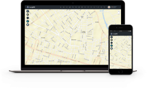
Geographic information System that allows utilities, governmental, industrial and commercial companies to model all the geographic elements (assets and resources) necessary to support decision making and improve staff productivity. Through the system, you can store, query, deploy, manage and analyze geospatial information, making your company more competitive and reducing operating costs.
Features:
WEB Administration
Third-Party Integration
Emergencies management in distribution networks
Distribution networks maintenance
Optimal routes calculation
User friendly interface
Cartographic edition power
Cost savings

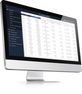
Information service that manages and controls the process of buying and selling natural gas, providing analysis and results in real time, under the contractual conditions defined by the costumer and service provider.
Features:
Centralization and Data Analysis
Configuration and execution of natural gas commercialization process
Customers and suppliers nomination process management (Natural gas purchase and sale
Large industrial and secondary market Customers provision and preliquidation systematic process execution
Relevant markets cost setting generation
Supplier invoice simulation
Regulated tariff calculation
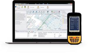
 Information system that allows the automation of the management of work orders and emergency care crews for utility companies.
Features:
Real-time geographic monitoring
Autonomy
Statistical information
Management automation
Third-Pary Integration